If a tree falls in a forest and no one is around to hear it, does it make a sound? What about a rainstorm in the forest hundreds of years before people were measuring climate and weather? How can we know about the climate if there are no records? And how can we fully understand climate change without this information?
While there were no people recording this information, there is a record of it. In tree rings. And Erika Wise, assistant professor in the department of geography, is unearthing this data with a grant from the National Science Foundation.
All rainwater contains isotopes, or chemical signals, that identify where the water came from. When trees drink the water, the isotopes are trapped in its rings. The knowledge to pull information from the size of tree rings has existed for some time, but we now have the technology to pull these isotopes from the tree rings as well, providing us with a weather map from hundreds of years ago.
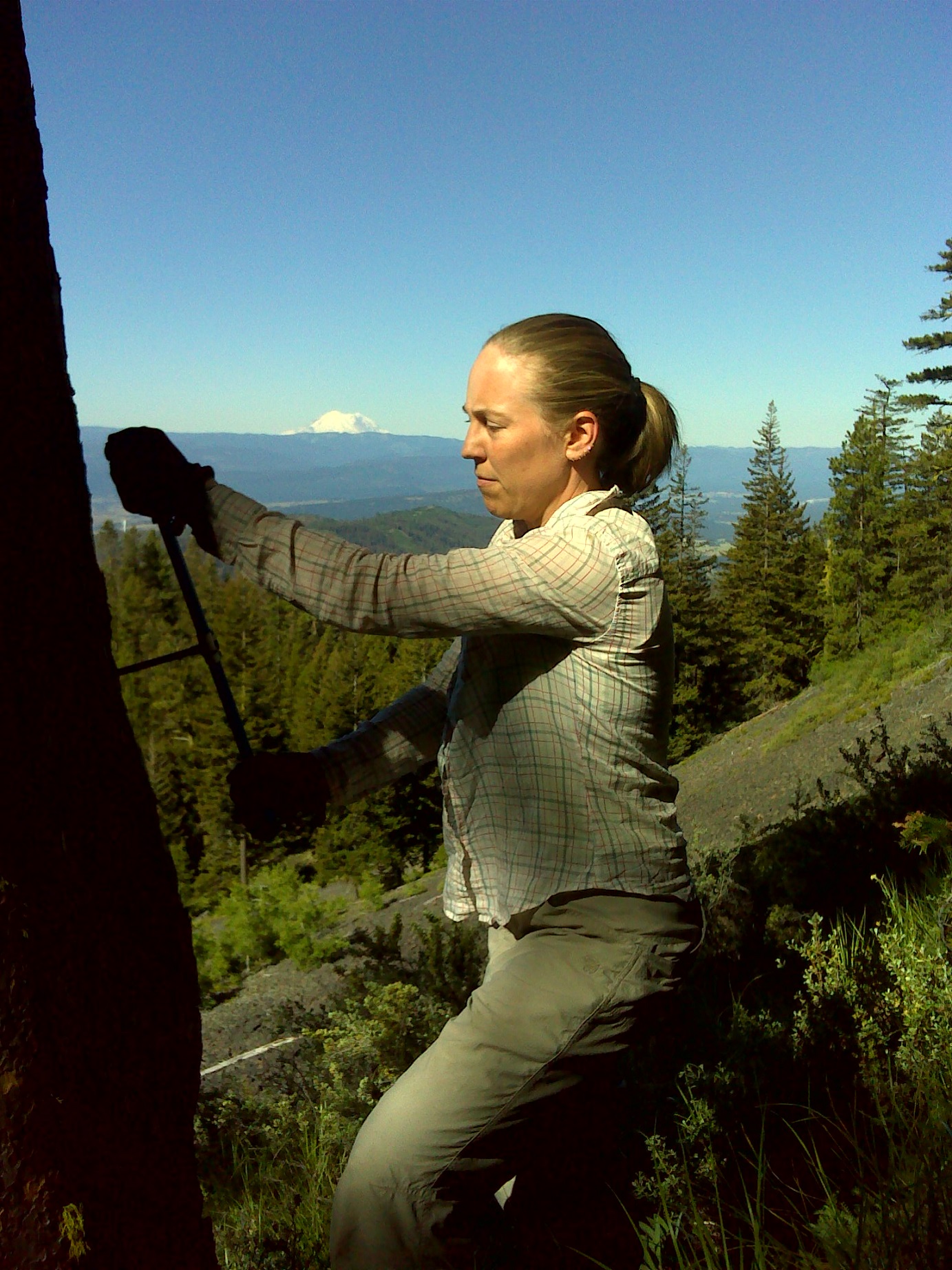
Wise is specifically concerned with the Pacific Northwest, an area known to have experienced severe, long droughts, unlike anything that has been seen since people have been collecting data in the region. She is working to discover if there has been a major change in weather patterns bringing moisture to the area, causing an end to the severe droughts.
Wise is also taking this research one step further, by teasing out more detailed information from the tree ring isotopes. A tree typically forms a ring each year of its life, and each ring has two parts – one light area formed in the early spring and influenced by winter climate, and one dark area formed in the late summer influenced by summer conditions. Wise’s research project will separate the isotopes for the two parts of the ring, providing seasonal information. This is one of the first research projects to attempt to separate the data to this degree of detail.
In order to collect information about the current isotopes in rainwater in the area, Wise and her colleagues are burying boxes next to the sample trees to collect soil moisture.
Another component of the research project involves citizen scientists, including local school children. These citizen scientists are collecting rain and snow in rain gauges, and sending the samples to be analyzed. In return, Wise and her colleagues are visiting the schools to tell them more about the project and the data found.
This research project is expected to take three years to complete, including two trips each year to collect the soil moisture samples and meet with the local schools and citizen scientists. This resulting data will tie into a network of tree ring data that provides information about atmospheric pressure and weather patterns through time, around the world.
Wise’s proposal for this grant was developed during her time as a Scholar-in-Residence at the Center for Urban & Regional Studies.